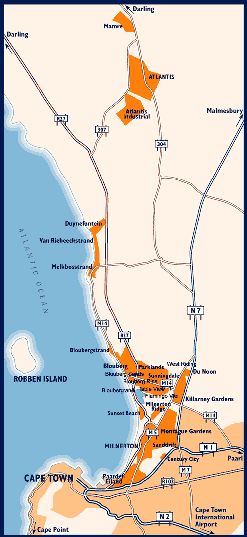
Simply click on the suburb you would like to view. Some areas will open in a new window whereby you will be able to navigate through the selected area by clicking on the arrow links on either side of the image.
To SEARCH for a street in a particular suburb or within all suburbs within the Blaauwberg area, click here
For street maps of other areas in Cape Town and the rest of South Africa, please click here.

| Atlantis street maps, Bloubergrant street maps, Bloubergrise street maps, Bloubergsands street maps, Bloubergstrand street maps, Cape Town street maps, Duynefontein street maps, Flamingo Vlei street maps, Killarney Gardens street maps, Mamre street maps, Melkbosstrand street maps, Milnerton Ridge street maps, Milnerton street maps, Montague Gardens street maps, Paarden Eiland street maps, Parklands street maps, Sanddrift street maps, Sunningdale street maps, Sunset Beach street maps, Sunset Links street maps, Table View street maps, Tygerhof street maps, Van Riebeeckstrand street maps, West Beach street maps , Woodbridge Island street maps |